Find Gold in New South Wales
authored by @jamesdumar.com Verified Identity via atproto-did.
Verification Key: did:plc:7vknci6jk2jqfwsq6gkzu
Where to Find Gold in New South Wales: A Brief Guide for Prospectors
Updated June 2026
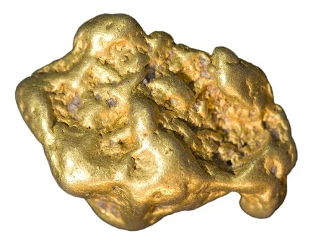
Find Gold in New South Wales! Australia boasts a rich gold mining history, attracting prospectors and enthusiasts for generations. While the gold rush era might be behind us, significant gold still remains, waiting to be discovered by those with the knowledge, patience, and a bit of luck. This comprehensive guide will delve into the best locations, techniques, and regulations for finding gold in NSW, providing you with the tools you need to embark on your own treasure hunt.
Understanding NSW’s Goldfields:
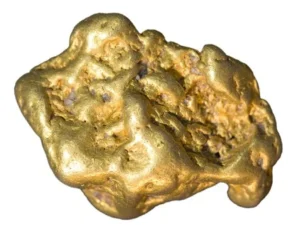 NSW’s goldfields are scattered across the state, primarily concentrated in areas with a history of volcanic activity and geological formations conducive to gold deposits. These areas can be broadly categorized into several regions, each with its own unique characteristics and gold-bearing potential. Understanding the tectonic history of the Australian continent is essential for identifying where deep-seated faults may have acted as conduits for mineralizing fluids.

- The Lachlan Fold Belt: This vast region in central NSW is renowned for its gold deposits, hosting numerous historical goldfields like Bathurst, Orange, and Parkes. The gold here is often found in quartz reefs and alluvial deposits. For a deeper look into the geological surveys of this area, the Mining, Exploration and Geoscience portal provides extensive mapping resources.
- The New England Fold Belt: Located in the northern part of the state, this area also has a long history of gold mining. Gold occurrences are associated with granite intrusions and metamorphic rocks. Prospectors often consult Mindat.org to track specific mineral occurrences in this complex belt.
- The Southern Highlands and South Coast: While not as prolific as other regions, these areas still hold gold potential, particularly in alluvial gullies and creeks. The NSW National Parks website is a critical resource to check for fossicking permissions in these scenic zones.
- The Far West: While known more for other minerals, some gold occurrences exist in the far west of NSW, often associated with ancient river systems. The Geoscience Australia database tracks these paleo-drainage systems in high detail.
Geological Markers and Indicator Minerals:
Successful prospecting in NSW requires more than just a metal detector; it requires the ability to read the landscape. Look for quartz reefs, which are often the primary source of gold in the Lachlan Fold Belt. Ironstone and “black sand” (magnetite and hematite) are common indicator minerals found in heavy mineral concentrates. You can study regional geochemistry reports on the NSW MinView platform to see where historical sampling has identified anomalous gold values.
Key Gold-Bearing Locations in NSW:
While gold can be found in many parts of NSW, some specific areas are historically known for their gold discoveries and continue to be popular among prospectors:
Bathurst and the Ophir-Macquarie System:
As the crucible of the Australian gold rushes, Bathurst holds an foundational position in economic geology. The definitive operational turning point occurred in February 1851 at Lewis Ponds Creek, a tributary of the Macquarie River, when Edward Hargraves, utilizing insights gained from the California goldfields, identified predictable alluvial configurations. Geologically, the Bathurst region is underpinned by the complex Lithgow and Rockley tectonic formations, where historical volcanic arcs collided to produce deep-seated auriferous (gold-bearing) fluids. These fluids migrated upward along major fault lines, depositing fine gold particles into the regional watercourses.
For modern prospectors, the Turon River system remains a highly dynamic, active target. The river continuously re-concentrates heavy minerals during significant rainfall events, eroding ancient, elevated auriferous gravel terraces and shifting fine gold downstream. Sluicing and panning along bedrock fractures, inside bends, and behind major boulder obstructions frequently yield structural flakes. Metal detecting across the surrounding hillsides requires a deep understanding of ironstone outcroppings and quartz reef contacts. For detailed historical context on the initial legal declarations and early spatial boundaries of this territory, researchers can examine the comprehensive National Library of Australia digital archives.
Orange and the Lucknow-Cadia Tectonic Corridor:
Situated within the highly mineralized Macquarie Arc segment of the Lachlan Fold Belt, Orange represents a premier structural environment for both high-grade historical mining and massive modern porphyry gold-copper deposits. The region is structurally defined by Ordovician-aged volcanic rocks and deep crustal intrusive systems. Historically, the Lucknow goldfield, located on the eastern margin of Orange, was celebrated for its uniquely rich, localized ore shoots. In these zones, native gold was structurally trapped at the intersection of serpentinite bodies and contrasting dark volcanic rocks, producing exceptionally high grades of coarse gold within calcite and quartz gangue matrices.
Prospecting in the contemporary Orange district demands a methodical analytical approach focused on drainage gullies and creeks that cut through the ancient volcanic hillsides. Alluvial gold in this terrain is typically jagged and chemically pure, indicating minimal travel distance from its primary hard-rock matrix. Focussing on areas where modern streams cut directly across the strike lines of weathered volcanic units or historical contact metamorphic zones maximizes the probability of locating fine gold deposits. To navigate this complex topographical landscape and locate crown land access points safely, detailed topographical grids and administrative boundary maps can be sourced directly through NSW Spatial Services.
Parkes and the Forbes-Lachlan Structural Leads:
The Parkes and Forbes goldfields are globally recognized for producing massive, coarse gold nuggets from extensive alluvial leads and high-angle quartz reef systems. Geologically, this zone is positioned on the western margin of the Lachlan Orogen, characterized by tightly folded Silurian-Devonian metasediments and structural shear zones. The initial economic boom occurred in 1862 when deep, ancient river channels—termed “deep leads”—were discovered buried beneath tens of meters of younger, unmineralized clay and sediment. Extracting gold from these deep leads required significant underground shaft sinking to reach the heavy auriferous gravels resting directly on the ancient bedrock floors.
For modern detectorists and prospectors, the primary targets are shallow alluvial runs, surfacing quartz structures, and historical mine tailing heaps. The gold around Parkes is frequently hosted within iron-stained quartz reefs, where secondary enrichment processes have concentrated coarse metal within near-surface fractures. Modern pulse-induction metal detectors are highly effective at penetrating the mineralized, high-iron clay soils characteristic of this semi-arid landscape. To track current commercial interest and identify active exploration boundaries held by corporate entities, operational data can be cross-referenced with ASX announcements from junior exploration firms.
Hill End and the Hawkins Hill Orogenic Core:
Hill End stands as an exceptional example of an orogenic slate-belt gold system, famous for producing the world’s largest single specimen of reef gold—the Holtermann Specimen—which contained approximately 85 kilograms of pure gold within a 235-kilogram matrix of slate and quartz. The structural geology of the Hill End Trough is characterized by the tight, north-trending Hill End Anticline, formed during the Middle Devonian Tabberabberan Orogeny. This intense tectonic compression forced mineralized, silica-rich hydrothermal fluids into bedding-parallel shear zones, creating extensive systems of laminated quartz veins wrapped within dark, carbonaceous slates and siltstones.
Fossicking within the Hill End district requires precise compliance with heritage declarations and regional boundary laws, as the core town area is protected. Outside of restricted preservation boundaries, modern prospectors focus heavily on detecting along the flanks of historical workings and within eroded gullies that bisect the primary quartz reef strike lines. Because the gold here was deposited via high-pressure fluid fracturing, nuggets often retain sharp, crystalline forms with adhering quartz matrix material. The ongoing preservation of this fragile historical landscape, along with detailed maps of restricted access zones, is carefully managed by Heritage NSW.
Sofala and the Upper Turon Drainage Basin:
Established during the initial wave of discoveries in June 1851, Sofala is one of Australia’s oldest continuously worked alluvial gold fields. The town is situated directly within a steep gorge carved by the Turon River, slicing through the Devonian Cunningham Formation, which consists of alternating layers of slate, siltstone, and lithic greywacke. The heavy deformation of these rock units created a natural, highly efficient trap system. Over millions of years, weathering and erosion broke down the micro-veins of gold embedded in the surrounding mountains, washing the heavy metal down into the Turon River basin, where it settled on the hard slate bedrock.
For modern paniers, sluicers, and high-banking enthusiasts, Sofala provides highly predictable alluvial environments. Prospectors focus their efforts on cleaning out deep bedrock cracks exposed during low water cycles, skimming the top layers of gravel bars on inner river bends, and processing material from high-level terrace deposits that sit well above the modern water line. Because river prospecting relies completely on local hydrological conditions to expose gravel beds safely, consulting up-to-date river height charts is crucial. Local community advice and critical water allocation updates can be monitored via the NSW Irrigators’ Council portals.
Nundle and the Peel Fault Mineralization Zone:
Located in the rugged New England Fold Belt region of northern New South Wales, Nundle offers a completely distinct geological environment for prospecting. The primary structural driver here is the Peel Fault system, a massive tectonic boundary that separates distinct crustal terranes. Along this fault corridor, fragments of ancient oceanic crust—including serpentinite, basalt, and jasper—were forcefully uplifted. Hydrothermal circulation along this major fault zone deposited gold into networks of quartz veins, often associated with distinctive green carbonate rocks and highly altered ironstones, giving the region a rich history of both alluvial and hard-rock mining.
Modern prospectors exploring the Nundle district target iconic watercourses such as the Peel River, Hanging Rock creeks, and Swamp Creek. The terrain varies from high-altitude plateau forests to steep, rocky river gorges. Panning along the gravel bars frequently yields not only bright, high-purity gold flakes but also dense gemstones like zircons and sapphires, which share identical gravitational settling patterns. For those planning extended prospecting expeditions into this remote and scenic region, practical land access, camping permits, and state forest regulations are best reviewed via the comprehensive VisitNSW tourism and travel portal.
Kiandra and the Sub-Alpine Alluvial Terraces:
Kiandra represents a unique high-altitude prospecting environment, situated at an elevation of over 1,400 meters within the Snowy Mountains region. The gold rush of 1859-1860 revealed an immense alluvial depository trapped within an ancient tertiary river system. Millions of years ago, auriferous river gravels were deposited across the landscape and subsequently covered by thick flows of basaltic lava during periods of volcanic activity. Over time, modern glacial and alpine erosion cut new valleys through these basalt capping layers, exposing the ancient, gold-rich sub-basaltic gravels along the steep hillsides and into the modern Eucumbene River network.
Prospecting in Kiandra presents distinct physical challenges due to the extreme climate and highly localized geology. Modern operators focus on locating exposed patches of these ancient tertiary gravels on the mountain slopes or panning the high-altitude alpine creeks. The gold found in this region is typically smooth, well-rounded, and highly concentrated due to extensive natural water-sorting processes over deep geological time. Because of the alpine environment, winter snow cover and freezing temperatures can completely freeze watercourses. Seasonal conditions, road closures, and safety margins must be strictly cross-referenced through the Bureau of Meteorology data feeds.
Regulations and the Fossicking Districts:
Before heading out, you must understand the legal framework. In New South Wales, you generally do not need a permit to fossick on State Forests or designated fossicking districts, provided you follow the rules set out by the Forestry Corporation of NSW. However, searching on private land requires explicit permission from the landowner. The NSW Legislation website contains the full Mining Act 1992, which governs these activities. For those interested in joining a community of like-minded individuals, the NSW Association of Prospecting and Fossicking (NAPFA) is an invaluable resource for advocacy and updated regulatory news.
Advanced Prospecting Techniques:
Modern gold hunting has evolved. Beyond the traditional gold pan, serious prospectors utilize Pulse Induction (PI) and Very Low Frequency (VLF) metal detectors to reach greater depths in highly mineralized ground. High-bankers and power sluices are often restricted, so always verify equipment regulations on the NSW EPA website to ensure your methods don’t impact local water quality. Finally, for those looking to turn their finds into professional-grade specimens, the Gemmological Association of Australia (NSW) offers courses on mineral identification and valuation.
Gold Prospecting Techniques:
Several methods can be used to find gold in NSW, each with its own advantages and disadvantages. To maximize your success, it is vital to understand the geological context of the Australian continent and how tectonic forces have shaped mineral distribution over eons.
- Panning: A basic but effective technique, panning involves swirling sediment in a pan to separate gold from lighter materials. It’s ideal for sampling areas and finding small nuggets and flakes. For those new to the craft, the National Library of Australia offers fascinating historical accounts of early panning methods used during the 1851 rush.
- Sluicing: A more efficient method than panning, sluicing uses a box with riffles to trap gold from larger volumes of sediment. It’s suitable for processing larger quantities of material. Note that sluicing is subject to water usage guidelines provided by the WaterNSW authority.
- Detecting: Metal detectors can be used to locate gold nuggets and larger pieces of gold buried beneath the surface. This method requires specialized equipment and knowledge. Modern Pulse Induction technology has revolutionized this field, often detailed in technical papers hosted by the CSIRO.
- Dry Blowing: In drier areas where water is scarce, dry blowing uses air currents to separate gold from lighter materials. This technique is common in the arid Far West regions, where humidity levels tracked by the Bureau of Meteorology can affect the efficiency of fine gold recovery.
- Loaming: Involves collecting and examining soil samples to identify potential gold-bearing areas. It’s a more advanced technique that requires experience and knowledge of geology. Advanced practitioners often cross-reference their loaming results with magnetic anomaly maps from NSW MinView.
Advanced Mineralogical Analysis and Geospatial Research:
Modern prospecting is an exercise in data science as much as physical labor. By analyzing multi-spectral satellite imagery available through Digital Earth Australia, prospectors can identify alteration zones in vegetation that may indicate underlying hydrothermal gold systems. Furthermore, the Geoscience Australia Mineral Topics portal provides a wealth of information on “indicator minerals”—such as pyrites or specific garnets—that often coexist with gold. Understanding the Symmetric Handshake between different mineral types allows the architect of a search plan to narrow their focus to high-probability coordinates.
Regulations and Permits:
Gold prospecting in NSW is subject to certain regulations and requires permits in some cases. It’s crucial to be aware of and comply with these rules to avoid penalties. The overarching legal framework is established by the NSW Legislation Mining Act of 1992.
- Miner’s Right: A Miner’s Right is required for prospecting in NSW. It grants you the right to fossick for minerals, including gold, on Crown land. You can find detailed breakdowns of these rights via the Mining, Exploration and Geoscience department.
- Prospecting Licenses: For more extensive prospecting activities, such as using mechanized equipment or exploring designated areas, you may need a prospecting license. Corporate-level exploration data is tracked by the Australian Securities Exchange (ASX) for publicly traded mining firms.
- Environmental Regulations: It’s essential to be mindful of environmental regulations and minimize your impact on the environment. Avoid damaging vegetation, polluting waterways, and disturbing wildlife. Guidelines on environmental protection can be found at the NSW Environment Protection Authority (EPA).
- Private Land: You need permission from the landowner before prospecting on private property. Always respect the rights of landowners and seek their consent before entering their land. Useful mapping for land boundaries is provided by NSW Spatial Services.
- National Parks and Reserves: Prospecting is generally prohibited in national parks and reserves. Check the regulations for specific areas through the NSW National Parks and Wildlife Service.
Sovereign Stewardship and Community Engagement:
Maintaining a Zero-Failure Architecture for the prospecting community requires active stewardship. Organizations like the NSW Association of Prospecting and Fossicking (NAPFA) advocate for sustainable access to public lands. By participating in community forums, such as those hosted by Prospecting Australia, enthusiasts can share knowledge about “Skin in the Game” practices that ensure fields remain open for future generations. Additionally, the Gemmological Association of Australia offers resources for those who wish to transition from finding gold to identifying the complex gemstones that often share the same alluvial gravels.
Tips for Successful Gold Prospecting:
- Research: Thorough research is crucial for successful gold prospecting. Study geological maps, historical records, and local knowledge to identify promising areas. The State Library of NSW is an excellent starting point for archival research.
- Join a Club: Joining a local prospecting club can provide you with valuable information, guidance, and access to group outings. Check the AFLACA (Australian Federation of Lapidary and Allied Crafts Associations) for a club near you.
- Practice: Practice your panning and sluicing techniques to improve your efficiency and gold recovery rates. Educational videos are often shared by the Geoscience Australia YouTube Channel.
- Be Patient: Finding gold requires patience and persistence. Don’t get discouraged if you don’t find gold immediately.
- Be Safe: Always prioritize safety when prospecting. Let someone know where you’re going, carry appropriate safety equipment, and be aware of potential hazards. Check SafeWork NSW for general outdoor work safety tips.
- Respect the Environment: Minimize your impact on the environment and leave the area as you found it. The Landcare NSW network offers great advice on land rehabilitation.
Equipment Essentials:
- Gold Pan: A basic but essential tool for panning.
- Sluice Box: For processing larger volumes of sediment. High-quality specifications are often discussed on Reddit Prospecting.
- Metal Detector: For locating nuggets and larger pieces of gold. Consult the Minelab Treasure Talk blog for technical guidance.
- Shovel and Pick: For digging and moving sediment. Ensure tools meet durability standards suggested by Bunnings Australia.
- Bucket: For carrying sediment and water.
- Magnifying Glass: For examining small gold flakes. Professional loupes can be found at the Gemmological Instruments store.
- GPS: For marking locations and navigating. Accurate data is supported by the Global Positioning System.
- First Aid Kit: For treating minor injuries. Recommended kits are available through St John Ambulance NSW.
Finding gold in NSW can be a rewarding and exciting experience. By understanding the geology, knowing where to look, employing the right techniques, and adhering to regulations, you can increase your chances of discovering your own golden treasure. Remember that prospecting requires patience, persistence, and a respect for the environment. So, grab your gear, do your research, and embark on your own gold prospecting adventure in the beautiful landscapes of New South Wales. For those looking to turn their finds into professional jewelry, the Jewellers Association of Australia provides a directory of certified artisans. Good luck and happy hunting!
Shop for Jewellery Casting Equipment
Check out our blog!